Browse the map. Keep the data.
The data behind a public web map is right there in your browser: the map drew itself with it. Geo Hound is the part that notices, writes it down, and hands it to you in a form your software will accept.
- 01
Install it and browse normally
Install from the Chrome Web Store; in Edge, the same listing installs once you allow extensions from other stores. There is nothing to configure. Open any site with a web map and the toolbar badge starts counting what it finds. You do not open developer tools and you do not go looking.
- 02
Open the popup to see what was caught
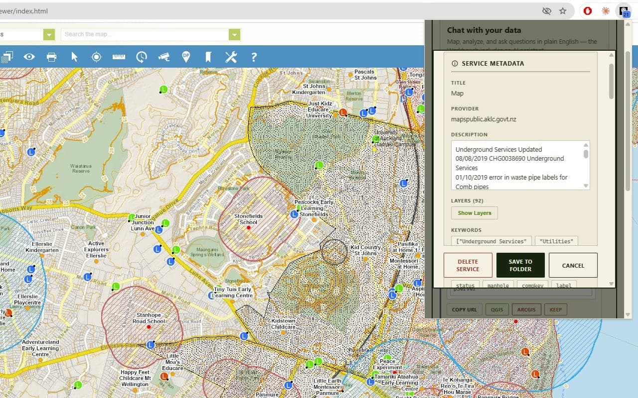
Each service is a card with its metadata already fetched: title, provider, layers, coordinate systems, keywords. 29 service and file types are recognised, from WMS and FeatureServer to OGC API and GeoPackage.
- 03
Take it to QGIS, or keep it in the browser
One click copies the URL pre-formatted for QGIS or ArcGIS Pro. Or open the workbench and add it as a live layer without leaving the browser.
- 04
Do the work
Filter the attribute table, select across layers, buffer, join, measure distances, symbolize, annotate, export. Or open the assistant tab and just ask.
Three layers, three sets of instructions.
Detector
What it catches, what a service card shows, testing CORS, copying for QGIS and ArcGIS Pro, folders and search, silencing noisy sites, and downloading data for an area you draw.
Read the documentationWorkbench
Adding layers, importing files, the attribute table and filter builder, selection, the analysis tools, symbology, annotations, exports, and sessions.
Read the documentationAssistant
A prompt cookbook, what the 26 tools do, exactly what data leaves your browser, how credits work, and how to restore a balance on a new machine.
Read the documentationShort questions have short answers on the frequently asked questions page.
How to do it by hand, and where Geo Hound saves you the trouble.
Most of what Geo Hound does you can do yourself with developer tools and patience. These guides explain both: the manual method, and the quick one.
Free to install.
The detector and the workbench are free, with no account. The assistant gives you up to 10 free questions a month.